SYSCLS ARMARKER GEO
| Name | SYSCLS_ARMARKER_GEO |
|---|---|
| Inheritance | AR-Marker Classification |
| Namespace | System.Classification.ARMARKER |
| ID | {74abfb6a-2345-4c1a-b0db-8337725f3bd2} |
| Purpose | Classify objects for absolute device pose calculation. |
| Version | - |
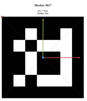
Detected AR-Markers in the POI View having this Classification will be used to calculate the device position and orientation (see AR-Marker Device Pose Estimation).
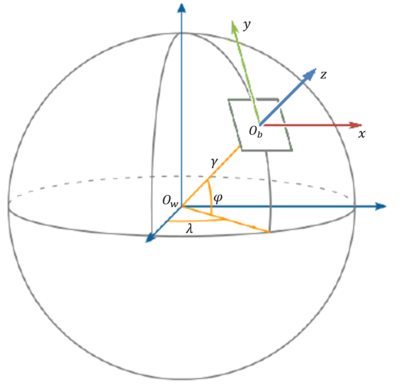
The GEO property defines the position of the AR-Marker within the WGS-84 world coordinate system. The rotation properties define the AR-Marker orientation in relation to the shown local coordinate system. Per default (and if all rotation properties are 0) the AR-Marker´s and local coordinate system´s axis are aligned. Rotations are applied in following order: z-y´-x´´. That means for example, that the y-rotation is applied after the rotation around the z-axis was performed.
MetaProperties
| Name | Data type | Comment |
|---|---|---|
| GEO | Geographic Coordinate | The location of the AR-Marker in WGS-84 coordinates (Longitude, Latitude). The altitude is defined as the elevation from ground in meters. |
| ARMARKERROLL | Double | Rotation of the marker in relation to the local coordinate system´s z-axis
Valid values: 0°…360° (clockwise) |
| ARMARKERYAW | Double | Rotation of the marker in relation to the local coordinate system´s y-axis
Valid values: 0°…360° (clockwise) |
| ARMARKERPITCH | Double | Rotation of the marker in relation to the local coordinate system´s x-axis
Valid values: 0°…360° (clockwise) |


